 |
Urban Planning 525 • Regional Planning •
Fall 2025
Prof.
Scott Campbell
[email protected]
(734) 763-2077
• OFFICE HOURS (in-person and online options)
Tuesdays & Thursdays 4:00 - 5:20 pm (first class: Tues, Aug 26)
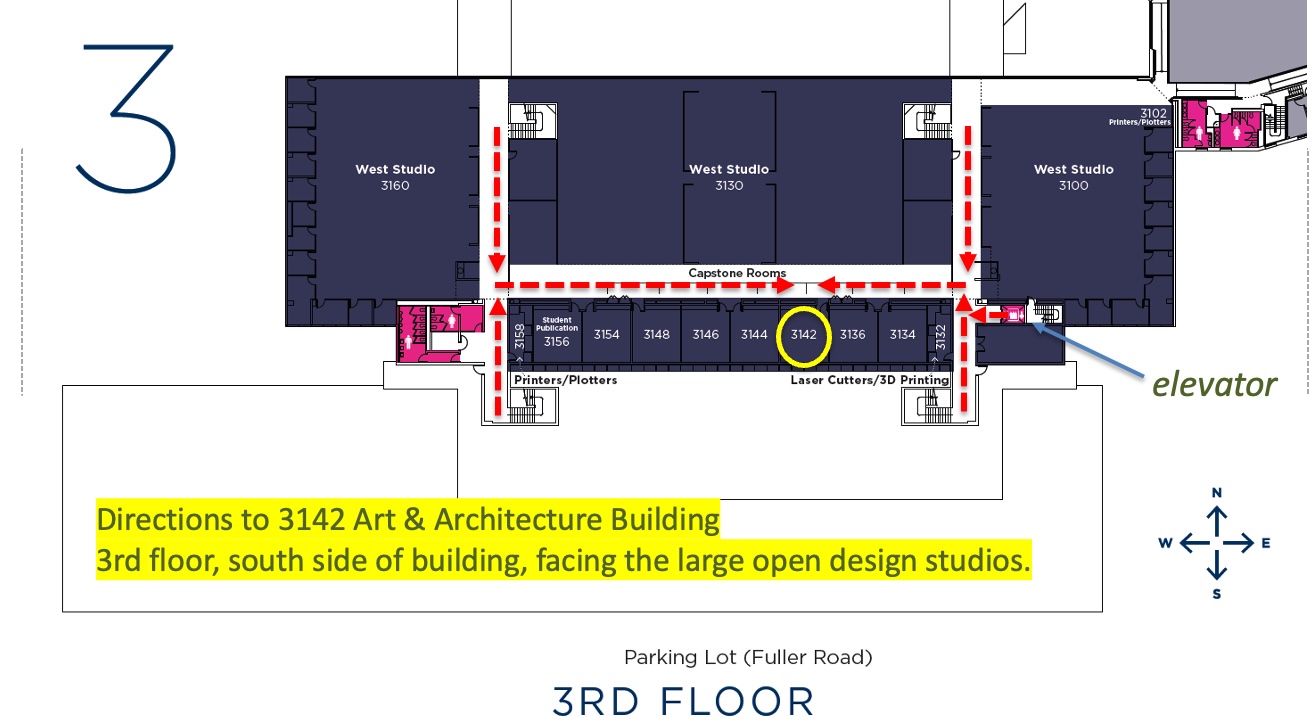
3142 Art & Architecture Building [new room as of Aug 28] (3rd floor, south side of building, facing the design studios) [map of classroom]
last
updated
Monday, November 24, 2025 11:33 PM
|
Readings: you can find readings in three different locations:
• Class Canvas site • class readings (usually pdf files) organized by Modules
• eBooks "bookshelf" (contains digital copies of full text books, available through the UM Library. set up a free account). Note: I have put many books on regionalism in this bookshelf, some are required readings, but most are simply available if you have deeper interests in a specific topic.
• via web links (I'll provide the url)
[Note: if the source not listed, the reading is located in Canvas]
• Course overview page (including a list of important concepts, terms, questions, examples -- i.e., a study guide)
• Shared Class Google Drive Folder
landmarks of US regional planning map [to be added]
 Assignments Assignments
|
Quick links to sections of this page (by dates and themes):
Course Overview
This graduate course provides an introduction to regional planning, development and analysis. The regionalist tradition represents a distinctive worldview to analyze metropolitan development, envision alternative conceptions and scales of community, and structure institutional responses to environmental, economic and social challenges. We examine the history, institutional practices, idealism and limitations of regional planning. Regional efforts have alternately targeted economic, environmental and social equity goals. Themes include regional economic development, land preservation, regional sustainability efforts, city-suburb relations, water resource management, megaregions, climate adaptation, and transportation infrastructure.
We examine the lack of regional planning in the United States both as American exceptionalism and as myth. We explore the disparities between regional idealism and the actual practice of regional planning and management, as well the divergent views of the region as an economic system, an infrastructural network, an ecological habitat, and an administrative district. Engaging the regional stance challenges us to question whether the city level is always the best scale to plan, map, design, and envision a better urban future.
An additional purpose of the course is to expand your sense of place and enrich your spatial imagination through regional case studies of New York, Metro Detroit, the San Francisco Bay Area, Los Angeles, Atlanta, the European Union and Asian megaregions.
Class Prerequisites
There are no formal prerequisites for this course. Previous coursework in urban planning, urban studies, local/regional politics, and/or environmental policy would be useful (but not necessary) preparation. Students from other programs (such as architecture, SEAS, public policy, business, social work, civil engineering, etc.) are encouraged to participate. Advanced undergrads with some background in urban planning courses are welcomed. I welcome all students to sit in on first week of class and see if the course is a good fit.
Assignments
Students are expected to complete all the required readings before the start of class and be ready to actively participate in class discussions. Students will also make group presentations, write five short response papers and one regional mapping/representation exercise. There will be a short final exam. LINK TO ASSIGNMENT PAGE.
[For a full overview of the course (with additional information), see this "overview" page.]
Schedule
of Weekly Readings (DRAFT -- will be updated over the semester]
Location of readings: Books available electronically via eBooks are labeled. If source not listed, the reading is located in Canvas (organized by Modules).
Central Questions for the Course include:
- What are regions? How do we map and visualize them? How does planning at the regional scale offer advantages over planning at the city scale?
- What are the pathways and obstacles to planning and coordination at the regional scale? Who are the largest boosters and opponents of regional management?
- How does the regional approach differ for land use planning, transportation planning, resource management, and economic development?
- How is the rise of megaregions (e.g., the Bos-Wash megalopolis; the Piedmont Atlantic; the Pacific Northwest’s Cascadia; the Texas Triangle) changing the way we envision urban areas, protect farmland and open space, and link communities by road and rail?
- How does the rise of semi-autonomous public authorities (often to build and manage infrastructure), such as port authorities, act as a model of regional planning?
- How do regional authorities collaborate – or compete -- with local and state agencies?
- Are some planning issues (e.g., transportation, water resources, park planning) better suited for regional-level coordination than others (e.g., welfare policy, housing)?
- How well can regional planning integrate economic and environmental concerns? How can the regionalist approach contribute to the great challenge to reverse climate change?
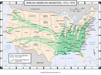
- How do we understand the dynamics, history and planning consequences of the great interregional shifts in population and economic activity: the 19th century westward settlement of the US Midwest, Prairie and West; the Great Migration (ca. 1910 – 1970); late 20th century Frostbelt-Sunbelt migration; pandemic-induced migration? What new planning challenges arise from these big demographic shifts?
- How will climate-induced migration transform regions?


.jpg)
Aug 28: The Case for Regional Planning; the Politics (Boosters, Coalitions and Oppositions)
Below are selections from two well-known edited books on regional planning, with a focus on the broader purpose and context of regional planning. Both books are available via the UM Library's eBooks system. Be sure to create your own free account for easy access to eBooks.
- Seltzer, Ethan, and Armando Carbonell, "Regional planning in America : practice and prospect," in Seltzer, Ethan, and Armando Carbonell. 2011. Regional planning in America : practice and prospect. Cambridge, Mass.: Lincoln Institute of Land Policy. Chapter 1 (pp. 1-16): [eBooks link]
- Kathryn A. Foster, "A Region of One's Own," in Seltzer and Carbonell (Chapter 3, pp. 53-80).
- Rosan, C. D. (2016). Governing the Fragmented Metropolis: Planning for Regional Sustainability. University of Pennsylvania Press. Chapter 1 (read pp 1-17), "Planning for a Metropolitan Future."
[alt source: access the entire book online via this link]
Optional Readings:
- Katz, Bruce, ed. 2000. Reflections
on Regionalism. Washington, DC: Brookings. see for example, the introduction by Bruce Katz, and Chapter 1: by Henry R. Richmond, "Metropolitan Land-Use
Reform: The Promise and Challenge of Majority Consensus"; Paul Dimond, "Empowering Families to Vote
with Their Feet," john a. powell , "Addressing Regional Dilemmas
for Minority Communities" [eBooks link]
- Tiebout, C. (1956), "A Pure Theory of Local Expenditures", Journal of Political Economy 64 (5): 416–424
- Frug,
Gerald E. 2002. Beyond Regional Government. Harvard Law Review 115:1763.
- Savitch, H. V., & Adhikari, S. (2017). Fragmented Regionalism: Why Metropolitan America Continues to Splinter. Urban Affairs Review, 53(2), 381–402. https://doi.org/10.1177/1078087416630626
- John Harrison, Daniel Galland & Mark Tewdwr-Jones (2021) Regional planning is dead: long live planning regional futures, Regional Studies, 55:1, 6-18, DOI: 10.1080/00343404.2020.1750580https://doi.org/10.1080/00343404.2020.1750580 [newly added]
Sep 2: Megaregions: the next step in the evolution of the region?
- Ross, Catherine L.(ed.). 2009. Megaregions : Planning for Global Competitiveness. Covelo, CA, USA: Island Press. [Introduction, Chs. 5, 6, 7, 10, 12, 13] [eBooks]
- Tracy Hadden Loh and Annelies Goger. 2020. In the age of American ‘megaregions,’ we must rethink governance across jurisdictions. Brookings report. May 7. [link]
Optional Readings:
- Woodall, B., Borowitz, M., Watkins, K., Costa, M., Howard, A., Kemerait, P., … Zhou, D. (2023). The megaregion – forms, functions, and potential? A literature review and proposal for advancing research. International Journal of Urban Sciences, 28(1), 82–104. https://doi-org.proxy.lib.umich.edu/10.1080/12265934.2023.2189156 [a useful summary of the megaregional research so far, with some helpful mapping ideas] [newly added]
- Regional Plan Association (RPA). 2009. Defining U.S. Megaregions.
- Cooperative Mobility for Competitive Megaregions (CM2) Consortium. What are Megaregions?
- Harrison, J., and Hoyler, M., eds. 2015. Megaregions : Globalization's New Urban Form? Cheltenham: Edward Elgar Publishing Limited. Accessed September 10, 2021. [eBooks]
- Xu, Jiang, and Yeh, Anthony G. O., eds. 2010. Governance and Planning of Mega-City Regions : An International Comparative Perspective. London: Taylor & Francis Group. [eBooks]
- Richard Florida, Tim Gulden, Charlotta Mellander, The rise of the mega-region, Cambridge Journal of Regions, Economy and Society, Volume 1, Issue 3, November 2008, Pages 459–476, https://doi-org.proxy.lib.umich.edu/10.1093/cjres/rsn018 [newly added]
- S. K. Kulshrestha. 2021. Planning Indian Megacity Regions. Springer Singapore.https://doi-org.proxy.lib.umich.edu/10.1007/978-981-16-5469-5 [newly added]
- Debnath Mookherjee. 2020. The Asian Megacity Region. Springer Nature Switzerland AG. https://doi-org.proxy.lib.umich.edu/10.1007/978-3-030-42649-1 [newly added]
- Harrison, J., & Gu, H. (2023). Arguing with megaregions: Learning from China’s chéngshì qún. Transactions in Planning and Urban Research, 2(1), 53-70. https://doi-org.proxy.lib.umich.edu/10.1177/27541223231157239 [newly added]
- Purkarthofer, E., Sielker, F., & Stead, D. (2021). Soft planning in macro-regions and megaregions: creating toothless spatial imaginaries or new forces for change? International Planning Studies, 27(2), 120–138. https://doi-org.proxy.lib.umich.edu/10.1080/13563475.2021.1972796 [newly added]
- Robert D. Yaro, Ming Zhang, and Frederick R. Steiner. 2022. Megaregions and America’s Future . USDOT Tier 1 Center: Cooperative Mobility for Competitive Megaregions At The University of Texas at Austin. March 2022. [to be added]
- Barnett, Jonathan. 2020. Designing the Megaregion: Meeting Urban Challenges at a New Scale. Washington, DC: Island Press. [to be added]
Link to google doc for use during in-class small group discussion
Sep 4: Interregional Migration, Regional Growth and Decline, and the Remapping of America
The (optional but encouraged) Task:
Pick an example of migration, either intra-regional or inter-regional. Prepare a slide (or several if needed) that briefly gives an overview of this migration and its impact on regional development (either the internal restructuring and inequalities within the region, or the growth/decline/development of the region overall). Be ready to briefly talk about your example. (Hopefully these various examples will enrich our understanding of the rich, dynamic relationship between regional development/change and human migration.) Slides might include maps, timelines, graphics, data tables/charts, photos, text, etc. Here is the Link to google slide file with both instructions (on the first slide) and where you will upload your own slide example. Thank you.
readings:
rather than providing a specific list of required readings, I encourage you instead to read selectively about those examples and themes of migration that most interest you and help you complete the above task. Below are some suggested readings. (Note: there is a huge literature out there on migration from various perspectives and disciplines.) I will begin Monday's class with a broad overview of the basics of migration (from demography) and its relationship to regional growth and development. We will then listen to and discuss your examples (see above task).
- New York Times, "The Great Climate Migration Has Begun", July 2020. link.
- William H. Frey. 2004. "The New Great Migration: Black Americans’ Return to the South, 1965-2000", Brookings.
- see Charles Blow's new book on reversing the Great Migration (The Devil You Know: A Black Power Manifesto). an interview • a review
- Iceland J., Sharp G., Timberlake J.M., 2013. Sun Belt rising: Regional population change and the decline in black residential segregation, 1970–2009. Demography 50, 97–123.
- Innis-Jiménez, Michael. 2013. Steel Barrio : The Great Mexican Migration to South Chicago, 1915-1940. New York: New York University Press. [eBooks]
- Schulman, Bruce J.. 1991. From Cotton Belt to Sunbelt : Federal Policy, Economic Development, and the Transformation of the South, 1938-1980. Cary: Oxford University Press, Incorporated. [Ebook]
- Nickerson, Michelle, and Dochuk, Darren, eds. 2011. Sunbelt Rising : The Politics of Space, Place, and Region. Philadelphia: University of Pennsylvania Press. [Ebook]
- McDonald, John. 2008. Urban America : Growth, Crisis, and Rebirth. Armonk: Taylor & Francis Group. [ Ebook] (see the chapters on the Sunbelt for a basic overview of the rise of this region)
- Triandafyllidou, Anna, ed. 2018. Handbook of Migration and Globalisation. Cheltenham, Gloucestershire: Edward Elgar Publishing Limited. [ Ebook].
- International Organization for Migration (IOM) & UN Habitat. 2021. INTEGRATING MIGRATION INTO URBAN DEVELOPMENT PROGRAMMES.
- Emily Badger. 2021. Covid Didn't Kill Cities. Why Was That Prophecy So Alluring? The New York Times. July 12.
- Derek Thompson. 2021. Superstar Cities Are in Trouble The past year has offered a glimpse of the nowhere-everywhere future of work, and it isn't optimistic for big cities.The Atlantic. Feb 1.
- David Sirota and Julia Rock. 2021. Parts of the US are getting dangerously hot. Yet Americans are moving the wrong way. [opinion] The Guardian. Aug 16.
- Abrahm Lustgarten. 2020. Climate Change Will Force a New American Migration. ProPublica. Sep 15. [see also NYTimesarticle]
- Asya Pisarevskaya, Nathan Levy, Peter Scholten, Joost Jansen, Mapping migration studies: An empirical analysis of the coming of age of a research field, Migration Studies, Volume 8, Issue 3, September 2020, Pages 455–481.
- Liu, Y., Stillwell, J., Shen, J. et al. Interprovincial Migration, Regional Development and State Policy in China, 1985–2010. Appl. Spatial Analysis 7, 47–70 (2014). https://doi-org.proxy.lib.umich.edu/10.1007/s12061-014-9102-6
- David Byler, 2021, Why California’s population boom has stalled . Washington Post. March 31.
- PPIC. 2021. California’s Stalled Population Growth.
- New American Economy. 2011. Immigration and North Carolina North Carolina’s Research Triangle Park Supports Innovation, Spurs Job Creation
- Fishman R. The Fifth Migration. Journal of the American Planning Association. 2005;71(4):357-366. [in Canvas]
- Molloy, Raven, Christopher L. Smith, and Abigail Wozniak. “Internal Migration in the United States.” The Journal of Economic Perspectives 25, no. 3 (2011): 173–96. [in Canvas]
Migration Data and Mapping:
US Census: Census Flows Mapper * Internal Migration in The U.S. - Exploring the Census Flows Mapper * State-to-State Migration Flows * Migration/Geographic Mobility • CPS Historical Migration/Geographic Mobility Tables • Data • Migration Flows Data Available for Counties, Metropolitan Statistical Areas and Minor Civil Divisions
NY Times: Mapping Migration in the United States
[Note: if you are not a subscriber to a newspaper and you hit a paywall, you can access the article through the UM Library. But even better: UM students are provided access to the NY Times through the central student government.
There's quick registration process, but once you complete it, you should have access to direct links. https://www.csg.umich.edu/subscriptions [You can also get a subscription to the Wall Street Journal.]
Link to google slide file -- where you can add your own example (to be discussed in class)
Sep 9: Mapping and Visualizing the Region: short lecture and workshop
[Note: we will conclude your optional short presentations of migration slides/examples at the beginning of class before moving to the question of regions and visualization.]
I will begin the class with some basic ideas and guidelines about representing regions. We will then spend most of the class in a quasi-workshop format. The goal is to give you a jump start on the regional mapping assignment (due Nov 13): sharing ideas, tips, methods, questions, obstacles. My plan is to have you break into small groups to share ideas with each other about the assignment (see below).
I will provide some optional background readings (on mapping, regional concepts) on the syllabus, but focus your preparation efforts for tomorrow’s class on beginning to think about your mapping assignment.
To Do before class:
Review this google shared doc on mapping resources and examples. Please provide comments on any mapping tools you know or have tried (including user experiences, praise and criticism), and add any examples of maps (and mapping resources) you find: URP525 (Fall 2025): Resources for the Regional Mapping Task
[Note: don’t be shy about adding to this page: all experiences with mapping tools and resources will be useful.]
Please review this sheet, but you have a lot of time to finalize your mapping case study choice (i.e., please pick a case in the coming weeks).
-->
Please fill in information on your mapping project on this document in the shared class google folder:
URP525 (Fall 2025): Student Worksheet for the Regional Mapping Task
For class:
Be ready discuss, with other students in a small group format, these questions:
a. What elements have you considered using to articulate/visualize the region? (e.g., centers, subcenters, corridors, networks, edges/boundaries, natural features)
b. What aspect(s) of the region are most important? Ecological? Economic? Social? Infrastructural? Political? etc. (will you focus on one, or try to combine several?)
c. How much will you defer to existing definitions of regions (e.g., using current US Census definitions of MSAs, etc. and follow county boundaries) or instead strive for an original, novel definition of the region and its boundaries?)
d. How are you planning to prepare your map? By hand? With a computer sketch application? GIS? etc. Will you use a base map?
e. What problems/challenges have you encountered or anticipated in this assignment? How might you get around these problems?
f. Do you think both the process of creating the map and the final map itself will alter how you (or others) will view and understand the region?
Some optional/background reading on maps and mapping:
- Dodge, Martin, Kitchin, Rob, and Perkins, Chris, eds. 2009. Rethinking Maps : New Frontiers in Cartographic Theory. London: Taylor & Francis Group. [eBooks]
- Wood, Denis. 2010. Rethinking the Power of Maps. New York: Guilford Publications. .[eBooks]
- Kriz, Karel, Cartwright, William, and Hurni, Lorenz, eds. 2010. Mapping Different Geographies. Berlin, Heidelberg: Springer Berlin / Heidelberg. [eBooks]
- Black, Jeremy. 2000. Maps and Politics. London: Reaktion Books, Limited. [Ebooks].
- Peterson, Michael P.. 2014. Mapping in the Cloud. New York: Guilford Publications. [ Ebooks]
- Crampton, Jeremy W.. 2010. Mapping : A Critical Introduction to Cartography and GIS. Chicester: John Wiley & Sons [Ebook].
- Engebretsen, Martin, and Kennedy, Helen, eds. 2020. Data Visualization in Society. Amsterdam: Amsterdam University Press. [eBook]
- Kraak, Menno-Jan, and Ormeling, Ferjan. 2020. Cartography : Visualization of Geospatial Data, Fourth Edition. Oxford: Taylor & Francis Group. [eBook]
- Harvey, Francis. 2015. A Primer of GIS : Fundamental Geographic and Cartographic Concepts. New York: Guilford Publications. [eBook]
- orangotango, ed. 2018. This Is Not an Atlas : A Global Collection of Counter-Cartographies. Bielefeld: transcript Verlag. [eBook]
- New York Public LIbrary. 2016. Digging Up the Nineteenth-Century Roots of Thematic Map Techniques. [link]
Sep 11: San Francisco Bay Area
- Walker, Richard A. 2009. Country in the City : The Greening of the San Francisco Bay Area. Seattle, WA, USA: University of Washington Press. [Introduction, Chs. 1-5] [eBooks]
optional background readings:
- Dyble, L. N. (2008). The Defeat of the Golden Gate Authority: A Special District, a Council of Governments, and the Fate of Regional Planning in the San Francisco Bay Area. Journal of Urban History, 34(2), 287-308. doi:10.1177/0096144207308661 [link]
- Lewis, Paul G., and Marantz, Nicholas J.. 2023. Regional Governance and the Politics of Housing in the San Francisco Bay Area. Philadelphia: Temple University Press. [eBooks
- Bills, T. S. (2024). Advancing the practice of regional transportation equity analysis: a San Francisco bay area case study. Transportation (Dordrecht), 51(3), 911-936. doi:10.1007/s11116-022-10355-z [link]
- Brahinsky, Rachel, et al. A People’s Guide to the San Francisco Bay Area. University of California Press, 2020. [UM Library link]
- Walker, Richard. Pictures of a Gone City?: Tech and the Dark Side of Prosperity in the San Francisco Bay Area. 1st ed., PM Press, 2018. [UM Library link]
Sep 16: San Francisco Bay Area - Day 2
- Walker, Richard A. 2009. Country in the City : The Greening of the San Francisco Bay Area. Seattle, WA, USA: University of Washington Press. [Introduction, Chs. 6-10, Conclusion] [eBooks]
- Hing Wong. "Regional Governance in the San Francisco Bay Area: The History of the Association of Bay Area Governments"
optional background readings:
Sep 18: NO CLASS [UPDATED SCHEDULE]
Since many students will be out of town for the Urban Planning "expanded Horizons" trip, we will not hold regular class today. If you would like to meet informally today (for example, to discuss your upcoming presentations), please contact me to arrange a meeting.
Sep 23: Detroit and Southeast Michigan, or Can a Region Thrive with a Struggling Central City?
- Barrow, Heather B. 2004. "'The American Disease of Growth': Henry Ford and the Metropolitanization of Detroit, 1920 - 1940." In Manufacturing Suburbs : Building Work and Home on the Metropolitan Fringe, edited by Robert Lewis. Philadelphia: Temple University Press. [eBooks]
- Sugrue, Thomas J. 1998. The Origins of the Urban Crisis. Princeton: Princeton Univ Press. [excerpt: chapter 5] see also entire book in eBooks]
- Galster, George. 2012. [Metropolitan Portraits] Driving Detroit: The Quest for Respect in the Motor City. Philadelphia, PA, USA: University of Pennsylvania Press. (Ch. 10. "What Drives Detroiters?" and Ch. 11. "From Motown to Mortropolis"; see also Ch. 2: "Sculpting Detroit: Polity and Economy Trump Geology") [eBooks]
see also:
- "The Developing Urban Detroit Area" (on the Doxiadis 1965 plan) • Doxiadis Plans Detroit•
- lecture by Prof. Robert Fishman, Detroit and the Acceleration of History
- SEMCOG • data and maps • publications
- Detroit Water and Sewerage Department
- Detroit Metropolitan Area Regional Planning Commission papers (online historical copies)
- Detroit Economic Growth Corporation
- Detroit Regional Chamber
- Detroit Future City
- Regional Transit Authority of Southeast Michigan
- Friends of the Detroit River
- Huron-Clinton Metroparks • map
- Detroit Cartography/Geography = DETROITography
- Thompson, Heather Ann. 2017. Whose Detroit? : Politics, Labor, and Race in a Modern American City. Ithaca: Cornell University Press. [eBooks]
- Darden, Joe T., and Thomas, Richard W.. 2013. Detroit : Race Riots, Racial Conflicts, and Efforts to Bridge the Racial Divide. Michigan State University Press. [eBooks]
- Barrow, Heather. 2018. Henry Ford’s Plan for the American Suburb : Dearborn and Detroit. Ithaca: Cornell University Press [eBooks}
- Thomas, June Manning. 2013. Redevelopment and Race : Planning a Finer City in Postwar Detroit. Detroit: Wayne State University Press. [eBooks]
- Gallagher, John. 2010. Reimagining Detroit : Opportunities for Redefining an American City. Detroit: Wayne State University Press. [eBooks]
- Martelle, Scott. 2014. Detroit : A Biography. Chicago: Chicago Review Press. Accessed [eBooks]
- Lisa Berglund. 2020. “The Shrinking City as a Growth Machine: Detroit’s Reinvention of Growth through Triage, Foundation Work and Talent Attraction.” International Journal of Urban and Regional Research, vol. 44, no. 2.
- D'Anieri, P 2007, Regional reform in historic perspective, Metropolitan planning institutions in Detroit, 1950–1990 (dissertation, urban planning, University of Michigan)
- Benjamin, G. A. 2011. Semcog's business as usual: failed model. Journal of Law in Society, 13(1), 155-196.
Sep 25: Detroit and Southeast Michigan - Day 2
- Manning Thomas, June, and Bekkering, Henco, eds. 2015. Mapping Detroit : Land, Community, and Shaping a City. Detroit: Wayne State University Press. [eBooks] (Ch 9. Redesigning Community with Propinquity: Fragments of Detroit’s Region, June Manning Thomas)
- Batterman, Joel, 2021, A_Metropolitan Dilemma (dissertation final version, urban planning, University of Michigan) [ please read Chapter 4 and the Conclusion.]
Metro Detroit Regionalism -- Worksheet for Small Groups
Sep 30: Detroit and Southeast Michigan - Student Presentation (Group 2)
Oct 2: New York City and the Tri-State area
- G. L. P., Regional Plan of New York and its Environs , Town Planning Review, 15-2 (1932-Nov.) p.123, (author, G. L. P.) [in Canvas]
- Benjamin, Gerald and Richard P. Nathan. 2001. Regionalism and Realism:
A Study of Governments in the New York Metropolitan Area. Washington,
DC: Brookings. selections from Chapters 1-6 eBooks]
background readings:
- Regional Plan Assoc., Inc, 1935. The Regional Plan and the R.P.A. [online text]
- Robert Yaro, & Tony Hiss. (1996). A Region at Risk?: The Third Regional Plan For The New York-New Jersey-Connecticut Metropolitan Area. Island Press. [link to digital copy via UM Library]
- Bloom, Nicholas Dagen. "5 The Challenge of Regional Planning". How States Shaped Postwar America: State Government and Urban Power, Chicago: University of Chicago Press, 2019, pp. 70-82.
- Philip Mark Plotch and Jen Nelles. 2023. Mobilizing the Metropolis How the Port Authority Built New York. University of Michigan Press. [link] [add to required readings?]
NOTE: the Regional Plan Association (RPA) has produced four regional plans:
- #1 in 1929, led by Thomas Adams;
- #2 in the 1960s (a series of reports), during an era of urban decline;
- #3 in 1996, called "A Region at Risk," with a focus on mass transit, open space preservation and revitalizing urban employment centers;
- #4 in 2017, now with a focus on transportation, climate change, housing.
Oct 7: New York City and the Tri-State area - Day 2
- Benjamin, Gerald and Richard P. Nathan. 2001. Regionalism and Realism:
A Study of Governments in the New York Metropolitan Area. Washington,
DC: Brookings. selections from Chapters 7 - 9; 11
- Robert Yaro, "Growing and Governing Smart:
A Case Study of the New York Region" in Katz, Bruce, ed. 2000. Reflections
on Regionalism. Washington, DC: Brookings. [eBooks link]
- Defilippis, James and Niedt, Christopher. "9. New York’s Suburbs in a Globalized Metropolitan Region". The Life of North American Suburbs, edited by Jan Nijman, Toronto: University of Toronto Press, 2020, pp. 170-198.
also: review the Fourth Regional Plan (RPA), including the executive summary
Oct 9: New York City and the Tri-State area - Student Presentation (Group 3)
Oct 14: NO CLASS
[Note: No class today due to the fall study break on Mon & Tues, Oct 13 & 14]
Oct 16: NO CLASS
[class cancelled today]
Oct 21: Case Study: Sunbelt Regionalism - Day 1, Los Angeles [rescheduled from Oct 16]
- Fulton, William B. 2001. The Reluctant Metropolis: The Politics of Urban
Growth in Los Angeles. Baltimore: Johns Hopkins University Press. [Introduction, Ch 3] [in Canvas]
- Pastor, Manuel, J. Eugene Grigsby, and Marta Lopez-Garza. 2000. Regions That Work : How Cities and Suburbs Can Grow Together. Minneapolis, MN, USA: University of Minnesota Press. (Chs. 1-3) [eBooks]
- Gottlieb, Robert. 2007. Reinventing Los Angeles : Nature and Community in the Global City. Cambridge, MA, USA: MIT Press.[Chs 1,3] [eBooks]
see also:
- Soja, Edward W.. 2014. My Los Angeles : From Urban Restructuring to Regional Urbanization. Berkeley: University of California Press. (Ch. 7: Regional Urbanization of the Metropolis Era and the End) [eBooks]
- Gottlieb, Robert. 2004. Next Los Angeles : The Struggle for a Livable City. Ewing, NJ, USA: University of California Press. [Chs 3, 5] [in Canvas]
- Pastor, Manuel, Jr., Chris Benner, and Martha Matsuoka. 2009. This Could Be the Start of Something Big : How Social Movements for Regional Equity Are Reshaping Metropolitan America. Ithaca, NY, USA: Cornell University Press. (Ch. 4) [eBooks]
- Storper, Michael, Kemeny, Thomas, Makarem, Naji, and Osman, Taner. 2015. The Rise and Fall of Urban Economies : Lessons from San Francisco and Los Angeles. Palo Alto: Stanford University Press. [eBooks]
- Deverell, William, and Hise, Greg, eds. 2010. A Companion to Los Angeles. Chicester: John Wiley & Sons, Incorporated. [eBooks]
- Southern California Association of Governments (SCAG)
Oct 23: Case Study: Sunbelt Regionalism - Day 2, Atlanta [rescheduled from Oct 21]
[Note: This Oct 23 session was originally not on the schedule, but has been reinserted]
- Basmajian, C.W. (2013). Atlanta Unbound: Enabling Sprawl through Policy and Planning. Philadelphia: Temple University Press. (Chs. 1-5, 7) [available through Project Muse]
see also:
- Kruse, K. M. (2005). White flight : Atlanta and the making of modern conservatism. Princeton, N.J.: Princeton University Press. [available through Project Muse] [here is a video of a brief lecture]
- Karen Pooley. 2015. Segregation's New Geography: The Atlanta Metro Region, Race, and the Declining Prospects for Upward Mobility. Southern Spaces. April 15. [with detailed information on African-American suburbanization]
- LeBeau, Rob. "Regional Planning for Livable Communities in Atlanta," in Montgomery, Carleton K., ed. 2011. Regional Planning for a Sustainable America : How Creative Programs Are Promoting Prosperity and Saving the Environment. Piscataway: Rutgers University Press. (Ch 15, p 177-190) [eBooks]
- ARC - Atlanta Regional Commission
- Center for Quality Growth and Regional Development (Georgia Tech)
- MARTA
- Sam Rosen. 2017. Atlanta's Controversial 'Cityhood' Movement: Recent border battles have once again redrawn the lines of the metro area. The Atlantic, April 26.
- Tim Craig. 2021. Amid surge in violent crime, Atlanta’s wealthiest neighborhood ponders new city. Washington Post. May 31.
- GPB: How Atlanta Became the City Too Busy to Hate | Civil Rights Movement (video)
- Geographies of Privilege and Exclusion: The 1938 Home Owner’s Loan Corporation “Residential Security Map” of Atlanta
Oct 28: Case Study: Sunbelt Regionalism - Student Presentation (Group 4)
Oct 30: Ecoregions: Sprawl and regional development, growth management, greenbelts, Suburban Retrofitting
- Saunders, William. 2005. Sprawl and Suburbia : A Harvard Design Magazine Reader. Minneapolis, MN, USA: University of Minnesota Press, 2005. (selected chapters: 1. Ellen Dunham- Jones, Seventy- five Percent: The Next Big Architectural Project; 4. Matthew J. Kiefer, Suburbia and Its Discontents: Notes from the Sprawl Debate; 5. Alex Krieger, The Costs— and Benefits?— of Sprawl; 6. Ellen Dunham- Jones, Smart Growth in Atlanta: A Response to Krieger and Kiefer [eBooks]
- Calthorpe, Peter. 2010. Urbanism in the Age of Climate Change. Covelo, CA, USA: Island Press. (Ch. 5: The Urban Footprint and Ch. 8: Four American Futures) [eBooks]
- Carl Abbott & Joy Margheim. (2008) Imagining Portland's Urban Growth Boundary: Planning Regulation as Cultural Icon, Journal of the American Planning Association, 74:2, 196-208.
see also:
- Ethan Seltzer. 2004. "It’s Not an Experiment: Regional Planning at Metro, 1990 to the Present" (Chapter 2), in Ozawa, C. P. ed. (2004). Portland Edge : Challenges in Growing Communities. Covelo, CA, USA: Island Press.
- Lindenmayer, David B., and Joem Fischer. 2006. Habitat Fragmentation and Landscape Change : An Ecological and Conservation Synthesis. Washington, DC, USA: Island Press. (Chapter 4: Approaches to Achieving Habitat Connectivity) [eBooks]
- Lang, Robert. Edgeless Cities : Exploring the Elusive Metropolis. Washington, DC, USA: Brookings Institution Press, 2003. [eBooks]
- NOTE: these sources NOT available in eBooks, but worth finding if you are interested in reading further:
Hellmund, Paul Cawood, and Daniel Smith. 2006. Designing Greenways : Sustainable Landscapes for Nature and People. Washington, DC, USA: Island Press (Chs. 1, 2) .
Calthorpe, Peter, and William Fulton. 2001. Regional City : New Urbanism and the End of Sprawl. Covelo, CA, USA: Island Press. (Chs. 1, 3, Conclusion)
- Seltzer, E., & Carbonell, A. (2011). Regional planning in America : practice and prospect. Cambridge, Mass.: Lincoln Institute of Land Policy. (Chs 2, 6). [eBooks link]
- Sale, Kirkpatrick. 2001. "There's no place like home..." The Ecologist: 31
(2): 40-43.
- Hiss, Tony. 1990. The Experience of Place: A new way of looking at and
dealing with out radically changing cities and countryside. New York:
Vintage. (Chapter 9, "Thinking Regionally," pp. 194-220.)
- Thayer, Robert L. 2003. Life-Place : Bioregional Thought and Practice. Ewing, NJ, USA: University of California Press. (Ch. 7: Planning: Designing a Life-Place) [eBooks]
- Anderson, Larry. 2002. Benton MacKaye : Conservationist, Planner, and Creator of the Appalachian Trail. Baltimore, MD, USA: Johns Hopkins University Press. (Chs. 1, 8-11). [eBooks]
- Bailey, Robert G.. Ecoregion-Based Design for Sustainability. Secaucus, NJ, USA: Springer, 2002. [ [eBooks]
- Bailey, Robert G.. 2009. Ecosystem Geography : From Ecoregions to Sites. New York: Springer New York. [eBooks]
- Anne Milne, Heather Kerr, Bart Welling, Chad Wriglesworth, Christine Cusick, Dan Wylie, Daniel Anderson, David Landis Barnhill, Erin James, and Harry Vandervlist. The Bioregional Imagination : Literature, Ecology, and Place. 2012. Athens: University of Georgia Press. [Ebook]
- Shi, Linda. 2019. Promise and paradox of metropolitan regional climate adaptation. Environmental Science & Policy, 92, 262-274. doi:https://doi.org/10.1016/j.envsci.2018.11.002.
Nov 4: Ecoregions: Water & the River Basin as Region (Day 2)
- Reisner, M. 1993. Cadillac desert: the American West and its disappearing
water. revised ed. New York and London: Penguin Books. (Introduction & Ch.
1, pp. 1-51)
- Abbott, Carl. How Cities Won the West : Four Centuries of Urban Change in Western North America. Albuquerque, NM, USA: University of New Mexico Press, 2010. (Ch. 9: Water, Power, Progress). [eBook]
- Annin, Peter. 2018. The Great Lakes Water Wars. Chicago: Island Press. (ideally read Chs 1,3,12,13) [Ebook]
see also:
- Mullin, Megan. 2009. Governing the Tap : Special District Governance and the New Local Politics of Water. Cambridge, MA, USA: MIT Press. (Ch. 1) [eBook]
- Gottlieb, Robert. Reinventing Los Angeles : Nature and Community in the Global City. Cambridge, MA, USA: MIT Press, 2007. (Ch. 3: Water for the City) [eBook]
- Summit, April. Contested Waters : An Environmental History of the Colorado River. Boulder, CO, USA: University Press of Colorado, 2013. [eBook]
- Aton, James M.. John Wesley Powell : His Life and Legacy. Salt Lake City, UT, USA: University of Utah Press, 2006. [eBook]
- Mulholland, Catherine. William Mulholland and the Rise of Los Angeles. Berkeley, CA, USA: University of California Press, 2002. [eBook]
- Benke, Arthur C., Cushing, Colbert E., and Benke, Arthur C, eds. 2005. Rivers of North America. Burlington: Elsevier Science & Technology. [eBook]
- BBC. The Forum. "The dam builders" (podcast). Released On: 23 Mar 2023. [link]
- Sarah Steffen. 2025. Fight over water intensifies as Colorado River dries up. Deutsche Welle (online). Oct 23.
Nov 6: Inter-Regional Climate Migration: Sending Regions, Receiving Regions
One hears much talk about the coming wave of climate migrants/refugees, with high risk areas (heat, flood, drought, storms, wildfire) losing populations to so-called "climate havens". (For example: Michiganders often optimistically speak of being one of these "havens," and anticipating that climate refugees will come to the state and reverse the below-average population growth in Michigan? But is this a likely scenario?) How do sending and receiving regions each prepare for this anticipated wave of humans on the move? If parts of Texas, Florida, Arizona, etc. are experiencing increasing risks from climate change-induced hazards such as storms, drought, flooding, fire and excessive heat (and correspondingly significant increases in property insurance costs), why do these regions continue to grow faster than the rest of the nation? And looking at climate migration worldwide, what might be the future out-migration patterns in high risk areas such as coastal Bangladesh, the Sundarban mangrove region of India, the Sahel Region of Africa, the Mekong Delta in Vietnam, coastal flooding in Indonesia and the Philippines, drought in Iran, etc.?)
- Tim Robustelli, Helen Bonnyman, Yuliya Panfil. 2024. Climate Migration’s Impact on Housing Security in the United States: Recommendations for Receiving Communities. New America. [link]
- Lawrence Huang. 2023. Climate Migration 101: An Explainer. Migration Policy Institute. [link]
- Allison Krugman. 2024. "On the Move": How Climate Migration Will Remake America. ThinkGlobalHealth. [link]
- ProPublica. The Great Climate Migration A Warming Planet and a Shifting Population. [link]
- Abrahm Lustgarten. 2025. The Great Climate Migration. The New York Times. [link]
TASK for class today: Each student should find either:
(1) an interesting example of climate migration (e.g., focusing either on the sending region and/or the receiving region); or perhaps on efforts to avoid climate displacement by adapting in-place (This example could be from anywhere in the world) OR
(2) an interesting article, book, report, etc. that you find that presents interesting, provocative, and/or novel ideas, arguments, data or history on the subject of climate migration. [be sure to provide a full citation of the text you find -- and a link if available]
Please be ready to briefly (e.g., in 2-3 minutes) discuss in class what you have found. Prepare a slide that helps illustrate what you discuss in your brief presentation. Add your slide to this shared google slide file (located in the class google folder).
see also:
- University of Toronto, School of Cities. Climate Displacement & Cities. [link]
- Li Gao, Abdoul G. Sam, Does climate matter? An empirical study of interregional migration in China, Papers in Regional Science, Volume 98, Issue 1, 2019, Pages 477-497, ISSN 1056-8190. [link]
- Kaczan, D.J., Orgill-Meyer, J. The impact of climate change on migration: a synthesis of recent empirical insights. Climatic Change 158, 281–300 (2020). [link]
- Rikani A, Frieler K, Schewe J (2022) Climate change and international migration: Exploring the macroeconomic channel. PLoS ONE 17(11): e0276764. https://doi.org/10.1371/journal.pone.0276764 [link]
- Burzynski M, Docquier F, Scheewel H. The geography of climate migration. Journal of Demographic Economics. 2021;87(3):345-381. doi:10.1017/dem.2021.6 [link]
- Bunting-Howarth, Katherine et al. (2023). People On The Move In A Changing Climate, Great Lakes Workshop Report .[link]
- Austyn Gaffney. 2025. The Climate Migration Question: Rebuild or Relocate? The New York Times. Jan 28. [link]
- Abrahm Lustgarten. 2025. That Giant Sucking Sound? It’s Climate Change Devouring Your Home’s Value. The New York Times. Feb 3. [link]
- The New York Times: visualizing international migration. [link]
- Abrahm Lustgarten. 2024. The Flooding Will Come “No Matter What”. ProPublica. [link]
- Van Berkel, D., Kalafatis, S., Gibbons, B., Naud, M., & Lemos, M. C. (2022). Planning for climate migration in Great Lake legacy cities. Earth's Future, 10, e2022EF002942. [link]
- Teicher, H. M., & Marchman, P. (2023). Integration as Adaptation: Advancing Research and Practice for Inclusive Climate Receiving Communities. Journal of the American Planning Association, 90(1), 30–49. https://doi.org/10.1080/01944363.2023.2188242 [link]
Nov 11: Ecoregions: Student Presentation (Group 5)
Nov 13: Global Regions - Globalization's Impact on Regional Planning and Development (including the rise of "global city-regions) in the US and Asia [rescheduled from Nov 18]
- Scott, Allen J., John Agnew, Edward W. Soja, and Michael Storper "Global City-Regions," in Scott, A. (Ed.) (2001). Global City-Regions: Trends Theory, Prospects. Oxford and New York: Oxford University Press. pp. 11-30. [in Canvas]
- Yu Li & Fulong Wu (2018) Understanding city-regionalism in China: regional cooperation in the Yangtze River Delta, Regional Studies, 52:3, 313-324 [also in Canvas]
- John Harrison & Hao Gu (2021) Planning megaregional futures: spatial imaginaries and megaregion formation in China, Regional Studies, 55:1, 77-89 [also in Canvas]
see also:
- Kidokoro, Tetsuo, Harata, Noboru, Subanu, L. P., Jessen, J., Motte, A., and Seltzer, E. P., eds. 2008. Sustainable City Regions: : Space, Place and Governance. Tokyo: Springer Japan. Accessed November 18, 2023.[eBook] (see, in particular, the introductory chapter; see also the case studies on many city regions in Japan, China, Thailand, Indonesia, Europe and the US)
- Xu, Jiang, and Yeh, Anthony G. O., eds. 2010. Governance and Planning of Mega-City Regions : An International Comparative Perspective. London: Taylor & Francis Group. [ Ebook]
- Kidokoro, Tetsuo, Harata, Noboru, Subanu, L. P., Jessen, J., Motte, A., and Seltzer, E. P., eds. 2008. Sustainable City Regions: : Space, Place and Governance. Tokyo: Springer Japan. [ Ebook]
- Hoffmann, Anne Marie. 2018. Regional Governance and Policy-Making in South America. Cham: Springer International Publishing AG. [ Ebook]
- Scott, Allen. 'Globalization and the Rise of City-Regions' GaWC Research Bulletin
26 (Z). [link]
- Sugden, R. and J.R. Wilson. 'Globalisation,
the New Economy and Regionalisation' GaWC Research Bulletin 70 (A) [link]
- Scott, Allen J., John Agnew, Edward W. Soja, and Michael Storper. 1999. "Global
City-Regions." (Conference Theme Paper). Global City-Regions Conference,
UCLA.
- Shan, W. e., & Yang, L. e. (2020). Metropolitan circles development and the future of urbanization: Institute of Public Policy, South China University of Technology : World Scientific. [UM Library link]
- John Harrison & Hao Gu (2021) Planning megaregional futures: spatial imaginaries and megaregion formation in China, Regional Studies, 55:1, 77-89. [link]
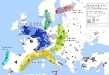
Nov 18: Global Regions - European Union and Regional Planning [rescheduled from Nov 20]
- Klaus Kunzmann. 2006. The Europeanization of Spatial Planning, in Adams, Neil (Editor). Regional Development and Spatial Planning in an Enlarged European Union. Abingdon, Oxon, UK: Ashgate Publishing Group. (Chapter 3) [also available online via Taylor and Francis]
- Taylor, P.J. 'Regionality within Globalization: What Does it Mean
for Europe?'GaWC Research Bulletin 35 (Z) html
- Krätke,
S. The Metropolization of the European Urban and Regional System GaWC Research
Bulletin 193 html
- Albrechts,
Louis, Patsy Healey, Klaus R Kunzmann. 2003. Strategic spatial planning and
regional governance in Europe. Journal
of the American Planning Association.Vol.69, Iss. 2 (Spring): 113
- 129
- Faludi, Andrea, "The Megalopolis, the Blue Banana, and Global Economic Integration Zones in European Planning Thought," in Ross, Catherine L.(ed.). 2009. Megaregions : Planning for Global Competitiveness. Covelo, CA, USA: Island Press. [eBooks]
see also:
- McCann, P.. 2015. Regional and Urban Policy of the European Union : Cohesion, Results-Orientation and Smart Specialisation. Cheltenham: Edward Elgar Publishing Limited.[Ebook]
- Faludi, Andreas. 2010. Cohesion, Coherence, Cooperation: European Spatial Planning Coming of Age? : European Spatial Planning Coming of Age?. London: Taylor & Francis Group. [ Ebook]
Nov 20: Student Presentations of Maps: Visualizing the Region (and its multiple overlapping layers, networks and identities) [rescheduled from Nov 13]
You will upload your slides here (in this google slide file)
[see the assignment page for the assignment instructions]
Nov 25: Student Presentation (Group 6)
Nov 27: NO CLASS: Thanksgiving Break

Dec 2: Final Week: Synthesis & Future Directions for Regionalism -- Student Presentations and Discussion
[add slide(s) to this shared google slide file]
see final class task, including short presentations.
Dec 4: Exam
see assignment page for details and also the Key Concepts, Questions, Themes on the course overview page (which can serve as a useful study guide)