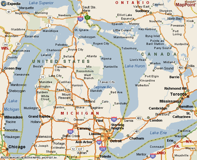
Map 1 - Michigan's Tawas Point State Park is on the northwest shore of Lake Huron's Saginaw Bay, west across the bay from Michigan's "thumb." It is near Tawas City (see the map) and East Tawas. To reach Tawas Point State Park from much of lower Michigan many birders will start out on I-75, US-23, or I-96.
Map 2 - If you are coming from the south on US-23 or from the east or west on I-96, you will run into I-75 at Flint. Take I-75 north past Saginaw, Bay City, and Midland.
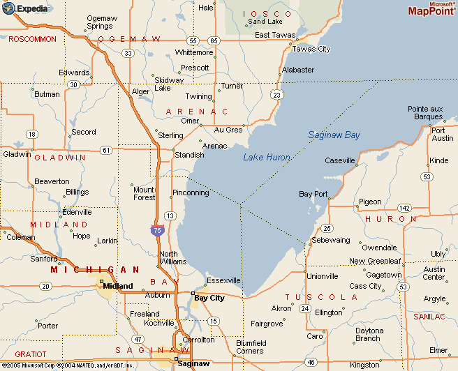
Map 3 - You can continue north on I-75 to near Standish and from there follow US-23. (US-23 is merged with I-75 from Flint to Standish.) US-23 goes north and east and will take you to East Tawas, where you will exit for Tawas Point State Park.
Instead of taking I-75 to US-23 at Standish, you may want to exit from I-75 at
M-13 at Bay City in order to go to Bay City State Recreation Area and, several miles north, Nayanquing Point Wildlife Area. There is easy access from M-13 to these two excellent birding sites. Continuing north on M-13 you will come to US-23 at Standish.
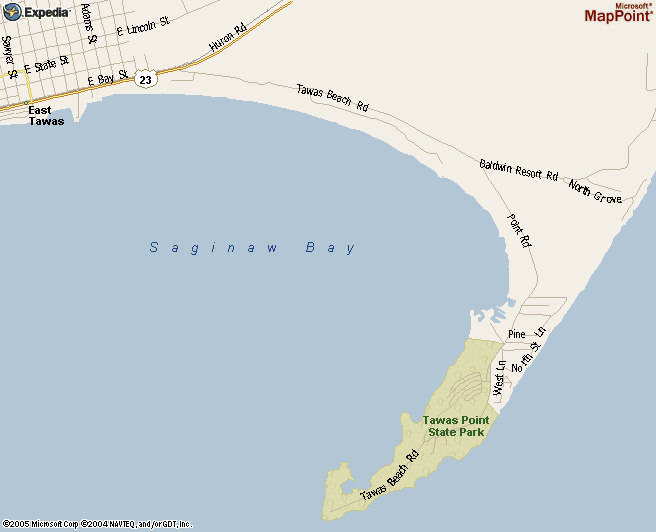
Map 4 - US-23 takes you east from Standish to the Saginaw Bay shore, which you will follow as you continue north for something more than 15 miles to East Tawas.
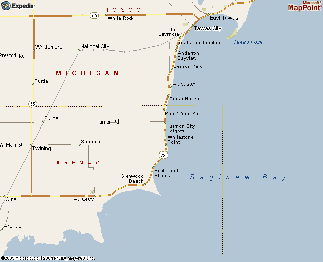
Map 5 - At the north edge of East Tawas you will see a sign for Tawas Bay State Park. Turn off US-23 to the right onto Tawas Beach Road and continue for 1.7 miles. You will come to a fork in the road. Bear right to stay on Tawas Beach Road/Point Road.
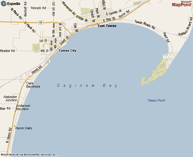
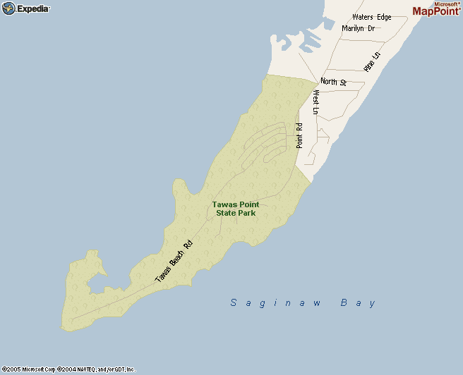
Map 6 - One mile ahead on Tawas Beach Road/Point Road you will enter Tawas Point State Park. If you do not have a vehicle permit, you will need to purchase one (or a day permit) on the way into the park.
Map 7 - The entire park, including the campground area in the section at the north end, is only 1.3 miles long. You will be able to explore the entire park on foot. On this map what is marked as Tawas Beach Road in the southern half of the park is not a road but, rather, the sandy main trail.
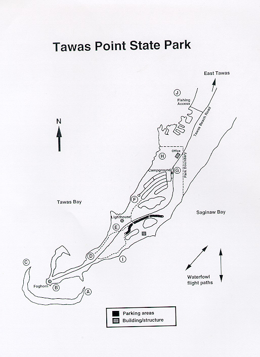
Map 8 - Park in one of the parking lots shown on this map. Walk south along the main trail and be sure to take the various side trails to check out the scrub, beaches, and the water--Saginaw Bay to the east and Tawas Bay to the west. The extensive sand bar shown off the tip can yield lots of shorebirds during migration.
There are restrooms in the "Building/structure" near the parking lots.
Click on any map below to get a separate, printable version.